Description
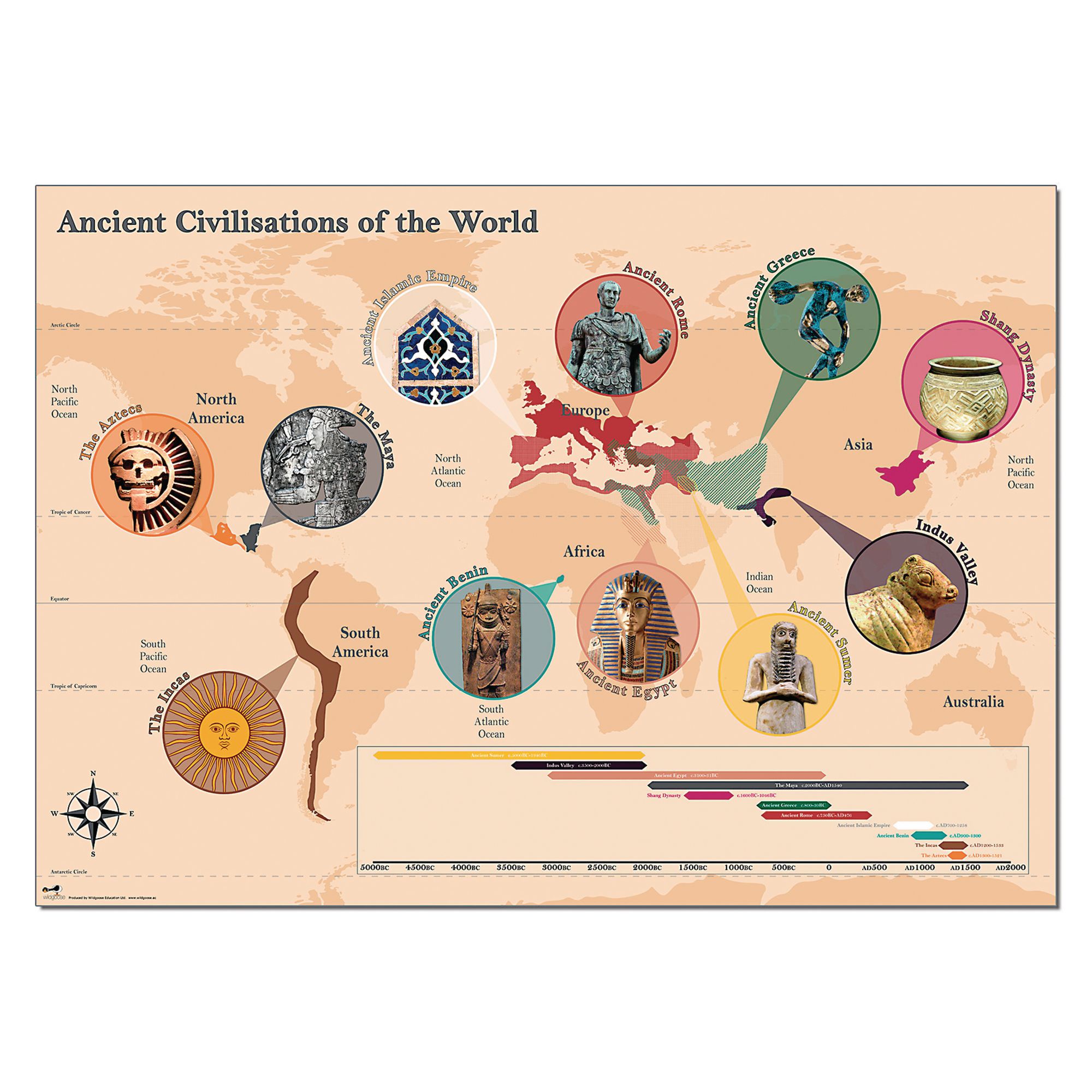
This detailed map is an ideal classroom resource for teaching ancient civilisations, helping pupils visualise the geographical spread and timeline of key empires such as Greece, Rome, and Egypt. Designed to support history lessons, it encourages chronological understanding and contextual learning for primary and secondary students.
Suitable for ages 7 years and above
Dimensions: 84 cm (height) x 59 cm (width)
Depicts multiple ancient civilisations
Includes a timeline for chronological reference
Supplied as a single map
An excellent display resource that puts ancient civilisations into geographical and historical context.
Specifications
Made In
GB
UNSPSC Code
60103806.0
Weight
95kg
Height
50mm
Width
50mm
Length
595mm
Brand
Own Brand
Categories
Ancient civilisations
Category
Resources